Maps & GIS
Salinas Open Data portal
What is GIS?
A geographic information system (GIS) is a framework for gathering, managing, and analyzing data. Rooted in the science of geography, GIS integrates many types of data. It analyzes spatial location and organizes layers of information into visualizations using maps and 3D scenes. With this unique capability, GIS reveals deeper insights into data, such as patterns, relationships, and situations—helping users make smarter decisions.
How is GIS related to Data Driven Decisions?
GIS is changing the way the world works through spatial analysis. Spatial analysis lets you evaluate suitability and capability, estimate and predict, interpret and understand, and much more, lending new perspectives to your decision-making. This is also referred to as Data Driven Decisions. GIS technology applies geographic science with tools for understanding and collaboration. It helps people reach a common goal: to gain actionable intelligence from all types of data. Todsay, hundreds of thousands of organizations in virtually every field are using GIS to make maps that communicate, perform analysis, share information, and solve complex problems around the world.
Where can I find City related Data?
Map Gallery - View Salinas Data
We are happy to provide many of our PDF maps, interactive maps, and data through the Map Gallery. Follow the link below to visit the Map Gallery.
New Salinas Map Gallery.
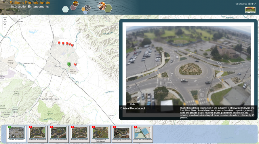
Story Maps
The City of Salinas GIS Division is happy to provide Story Maps. Using the Esri Story Map platform, we can now keep you up-to-speed on all the exciting projects the city is doing to improve our city. A story map leverages the power of geography and combines it with images, narratives, and multimedia content to tell you about the important things we are doing to help our communities prosper.
For example, one Story Map is about Salinas Traffic Calming Projects, details ongoing and implemented measures taken to reduce speed and traffic volumes in residential areas. As projects progress, our story maps will be updated to provide you with the most current information on housing, parks, Downtown Complete Streets and upcoming city projects. Check out our list, or dashboard, of Story Maps by visiting the link below.
Visit our Story Map Dashboard!
And More...
Some of the many maps and services the GIS Division provides include the development of National Pollutant Discharge Elimination System (NPDES) requirements, provide support for the General Plan Update, aid in the development of the Alisal Vibrancy Plan as well as providing maps and services for Parking, Construction, Urban Greening Plan, Pavement and Sidewalks Management, etc.
Note: Please download and read our GIS disclaimer and data use instructions before using any of this data.
Mission
The Geographic Information System (GIS) Division’s primary function is to provide mapping and spatial analysis support to City departments. The City of Salinas GIS Division is being developed to make information easily accessible in a manner that will assist other City departments in making informed decisions on City operational and planning activities. A secondary function of the Division is to be able to offer GIS services to other public and private entities at a reasonable cost.
Goals
The primary goals of the GIS Division are:
- Improve GIS Enterprise System Capability
- Expand the Impact of Shared Information
- Support Data Informed Decisions
- Improve Business Process
- Enhance Local Government Transparency
Focus Areas of the GIS Division
Map Production
Emergency Operations Support
Spatial Analysis
Staff Training (GIS)
Predictive Modeling
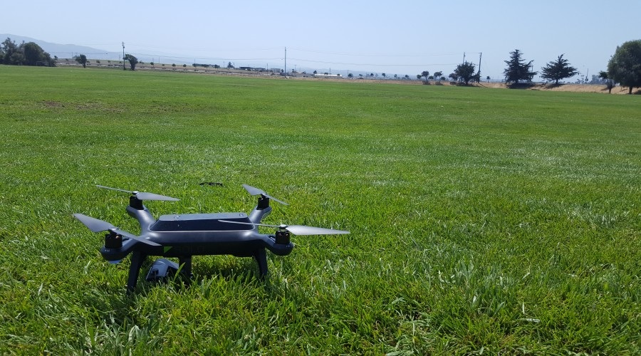
Remote Sensing (LiDAR, Drones)
Transportation/Route Modeling
Asset Management (trees, sidewalks)
Desktop App Development
Open Data
Mobile App Development
Business Process Integration
UAS Policy
Current Unmanned Aerial System (UAS) Draft Policy
Over the last several years, with budgets limited and staffing reaching critically low levels, the City of Salinas has progressively begun implementing state-of-the-art technology to help manage projects and assist with daily operations. These tools have proven to be of great assistance in maximizing the deployment of limited resources and providing services in our community. In recent months, City staff have conducted extensive research in the use of another such tool – Unmanned Aerial Systems. The result is the development of a draft UAS Policy.
The purpose of this policy is to establish guidelines for the City of Salinas' use of an Unmanned Aerial System (UAS). The City of Salinas has completed a number of public workshops, social media campaigns, and press releases to gain input from the public.
Unmanned aerial systems may be utilized to enhance effectiveness, timeliness, safety and cost savings of City activities that achieve Strategic Plan goals. Any use of a UAS will be in strict accordance with constitutional and privacy rights, State Law, existing City policy, and Federal Aviation Administration (FAA) regulations. Use by City of Salinas Public Safety shall be managed and regulated by their respective policies and procedures as well as relevant State and Federal law. Below is a link to the full policy:
UAS Draft Policy version 3.0(PDF, 33KB)
Council Report(PDF, 298KB)
Council Resolution
Media
KAZU
To hear more about the City of Salinas drone program, listen to the interview (below) by our local NPR station KAZU. Visit the KAZU webpage to see the article.
See what we have been up to...
The City of Salinas is part of the What Works Cities Initiative
Launched by Bloomberg Philanthropies, What Works Cities is a nation wide initiative that aids mid-sized American cities in improving their use of local services for their residents through specific components and standards. This program recognizes local governments that are leading the nation with the use of data to increase local decision-making, increase government effectiveness and in turn improve government services.
What Works Cities rewards local leaders in their use of data to improve people's lives and provides a path to progress for their communities. The City of Salinas recently became What Works Cities Certified and will be supported by Bloomberg Philanthropies in redefining what city halls across America are capable of achieving.
Find out more about What Works Cities
The City of Salinas was a Finalist for Amazon's City on a Cloud Innovation Challenge
Amazon Web Services is working towards helping local and regional governments innovate by simplifying IT workloads that are challenging and making it easier for governments to deliver services to their residents. Through the City on a Cloud Innovation Challenge, Amazon Web Services recognizes organizations that serve as hubs of innovation and leadership.
Find out more about Amazon's City on a Cloud Innovation Challenge